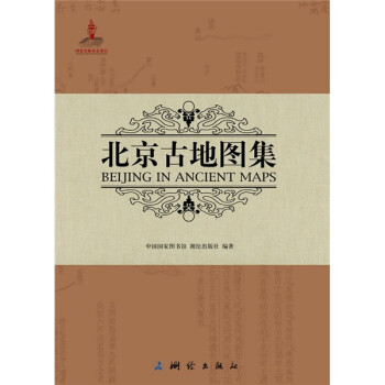
内容简介:
该《北京古地图集》是从国家图书馆地图专藏和书型古籍中遴选出的59种113幅有关北京的中外古旧地图,按成书(图)的时间先后编排而成,旨在通过展现古代北京在全国的空间位置、所属所管沿革,尤其是通过展示北京城市的空间布局、市政建设等发展变化,勾勒出北京城市的空间发展轨迹,并通过文字介绍相关背景,解读这些古旧地图背后的历史,为全方位了解北京城市发展提供丰富的信息。
从本图集收录的几种宋元时期成图的地图中,如《历代地理指掌图》、《禹跡?》、《华夷图》等,我们可以清楚看到北京从远古时期的蓟城到辽代的燕京、南京,再到金人的中都、元代的大都的历史沿革。丰富的明清时期及民国时期的地图则更加清晰地揭示了北京在“北平”、“北京”、“北京特别市”等名称变化中所折射出的地位变化。北京曾经的所辖所属也在“腹里图”、“北直隶图”等图及相关地名标识中得以体现。
从上个世纪九十年代开始,国内已经陆续出版了《中国古代地图集》三卷本、《中国古代地图集》城市地图卷、《中华古地图珍品集》等若干部古地图图集。与同类地图集相比,虽然有些地图已经被收入出版,但《北京古地图集》所选地图 集中于北京城,就一个城市的地图来说,无论数量、形式和内容的丰富性,其它图集都不能堪比,《北京古地图集》选入一些外国人绘制的北京地图,也是以往中国古地图集从未有过的特点,可以通过中外地图的对比来启发读者的思考;而且地图的文字说明采用中英文对照,更符合现代中国出版物推向国际,有利于促进中外地图学史领域的文化交流。
目录:
010/ 序言
013/ 序言(英文)
018/ 古地图上的北京
024/ 古地图上的北京(英文)
026/ 禹迹图 (1136年)
028/ 华夷图 (1136年)
030/ 古今华夷区域总要图 (1185年)
031/ 帝喾九州之图 (1185年)
032/ 唐十道图 (1185年)
033/ 宋朝元丰九域图 (1185年)
034/ 地理图 (1190年)
036/ 燕地指掌之图 (1205年)
038/ 晋献契丹全燕之图 (1271年)
039/ 契丹地理之图 (1271年)
040/ 腹里图 (1297—1307年)
041/ 燕京图 (1325年)
042/ 腹里图 (1340年)
044/ 漕运总图 (北京部分) (1528年)
046/ 北京城宫殿之图 (1531-1561年)
054/ 九边全图 (蓟州附近) (1538年)
055/ 北直隶舆图 (1555年)
056/ 京师五城之图 (1560年)
058/ 金门图 (1573—1620年)
059/ 畿辅图 (1573—1620年)
060/ 顺天京城图 (1573—1620年)
061/ 京都众水图 (1573—1620年)
062/ 西山图 (1573—1620年)
063/ 玉泉山图 (1573—1620年)
064/ 河防一览图(北京附近) (1590年)
066/ 北直隶各府所属州县图 (1613年)
067/ 北直隶各郡诸名山总图 (1613年)
068/ 燕山图 (1613年)
069/ 九边图·皇都 (1628年)
070/ 分省防务图·北京幅 (1628年)
071/ 北京地图 (1636年)
072/ 新中国地图集(封面) (1655年)
073/ 北直隶与北京地图 (1655年)
074/ 京城图 (1683年)
075/ 皇城图 (1735年)
076/ 京城图 (1735年)
077/ 顺天府舆地图 (1735年)
078/ 北直隶省地图 (1737年)
080/ 八旗方位总图 (1738年)
082/ 镶黄旗满洲蒙古汉军地图 (1738年)
083/ 正白旗满洲蒙古汉军地图 (1738年)
084/ 镶白旗满洲蒙古汉军地图 (1738年)
085/ 镶蓝旗满洲蒙古汉军地图 (1738年)
086/ 镶黄旗满洲蒙古汉军地图 (1738年)
087/ 正红旗满洲蒙古汉军地图 (1738年)
088/ 镶红旗满洲蒙古汉军地图 (1738年)
089/ 镶蓝旗满洲蒙古汉军地图 (1738年)
090/ 乾隆京城全图 (汉经厂附近) (1750年)
092/ 乾隆京城全图 (北海附近) (1750年)
094/ 乾隆京城全图 (景山附近) (1750年)
096/ 乾隆京城全图 (隆福寺附近) (1750年)
097/ 乾隆京城全图 (鼓楼附近) (1750年)
098/ 北京内城地图 (1765年)
104/ 京城图 (1784年)
105/ 顺天府图 (1784年)
106/ 城池全图 (1788年)
107/ 大内图 (1788年)
108/ 皇城图 (1788年)
109/ 内城图 (1788年)
110/ 正蓝旗图 (1788年)
111/ 镶白旗图 (1788年)
112/ 正白旗图 (1788年)
113/ 镶黄旗图 (1788年)
114/ 镶蓝旗图 (1788年)
115/ 镶红旗图 (1788年)
116/ 正红旗图 (1788年)
117/ 正黄旗图 (1788年)
118/ 外城图 (1788年)
119/ 外城东北图 (1788年)
120/ 外城东南图 (1788年)
121/ 外城西北图 (1788年)
122/ 外城西南图 (1788年)
123/ 西山图 (1788年)
124/ 首善全图 (1796—1820年)
132/ 京师总图 (1805年)
133/ 大内总图 (1805年)
134/ 皇城总图 (1805年)
135/ 内城总图 (1805年)
136/ 正蓝旗居址之图 (1805年)
137/ 镶白旗居址之图 (1805年)
138/ 正白旗居址之图 (1805年)
139/ 镶黄旗居址之图 (1805年)
140/ 镶蓝旗居址之图 (1805年)
141/ 镶红旗居址之图 (1805年)
142/ 正红旗居址之图 (1805年)
143/ 正黄旗居址之图 (1805年)
144/ 外城总图 (1805年)
145/ 苑囿总图 (1805年)
146/ 北京城区图 (1817年)
154/ 天津至京都水陆地里全图 (1851—1861?)
170/ 京师城内首善全图 (1870年)
176/ 京城内外全图 (1875—1908年)
182/ 颐和园至西直门路程图(1875—1908年)
186/ 北京西郊地图 (1875—1908年)
194/ 京师城内首善全图 (1875—1908年)
200/ 北京内城图 (1899年)
202/ 订正改版北京详细地图 (1900—1911年)
208/ 北京全图 (1903年)
220/ 五园三山及外三营地图 (1904年)
228/ 京师全图 (1908年)
236/ 最新北京精细全图 (1909年)
242/ 北京自来水分配计划图 (1912—1930年)
248/ 近畿铁路路线图 (1912—1930年)
250/ 京师西北附近名胜及马路图 (1912—1949年)
256/ 北京新图—中华民国首善之地 (1915年)
268/ 北京游览地图(封面) (1916—1920年)
269/ 北京游览地图——北京皇城全图(1916—1920年)
270/ 北京游览地图——北京内城一览图(1916—1920年)
272/ 北京游览地图——北京外城一览图(1916—1920年)
274/ 北京游览地图——北京游览全图(1916—1920年)
276/ 京都市内外城地图 (1917年)
288/ 京畿四郊游览全图 (1922年)
290/ 北平特别市区域略图 (1928年)
296/ 北平邮务区舆图 (1930年)
308/ 新测实用北平都市全图 (1930—1931年)
320/ 北平四郊详图 (1934年)
328/ 北平城郊鸟瞰图 (1936年)
334/ 最新北京全图 (1940年)
342/ 最新北平大地图 (解放版) (1949年)
Contents
004/ Contents
010/ Preface (Chinese)
013/ Preface (English)
018/ City of Beijing on the Ancient Maps
024/ City of Beijing on the Ancient Maps (Summary)
026/ Yu Ji Tu (Map of the Tracks of Yu)(1136)
028/ Hua Yi Tu (Map of the Hua and Barbarian Territories between the Seas)(1136)
030/ General Map of China, Ancient and Present(1185)
031/ Map of the Nine States of Diku, Emperor Ku(1185)
032/ Map of the Ten Dao (Circuits) in the Tang Dynasty (1185)
033/ Map of the Nine Regions of Yuanfeng Period, Song Dynasty (1185)
034/ Geographic Map (1190)
036/ Geographic Map of the Location of Yan(1205)
038/ Map of Yan Presented to Khitan by Jin (1271)
039/ Map of Khitan(1271)
040/ Map of Central Province(1297—1307)
041/ Map of Yanjing(1325)
042/ Map of Central Province(1340)
044/ General Map of Canal Transport (Part of Beijing)(1528)
046/ Map of Palaces in the City of Beijing(1531—1561)
054/ Map of Frontier Defense (around Jizhou)(1538)
055/ Map of Bei Zhili (the North Metropolitan Areas)(1555)
056/ Map of the Five Divisions of the Capital(1560)
058/ Map of Jinmen (the Imperial City) (1573—1620)
059/ Map of Jifu (Metropolitan Area) (1573—1620)
060/ Map of the Capital Shuntian (1573—1620)
061/ Map of the Rivers in the Capital (1573—1620)
062/ Map of the Western Hills(1573—1620)
063/ Map of the Yuquan Mountain(1573—1620)
064/ Map of the Embankments (around Beijing area)(1590)
066/ Map of Counties Governed by the Bei Zhili(1613)
067/ Map of Famous Mountains in Bei Zhili (1613)
068/ Map of Yanshan(1613)
069/ Map of Nine Forts, Imperial Capital(1628)
070/ Provincial Defense Maps, Map of Beijing(1628)
071/ Map of Beijing(1636)
072/ Novus Atlas Sinensis (Cover) (1655)
073/ Pecheli sive Peking Imperii Sinarvm Provincia Prima (Map of Bei Zhili and Beijing) (1655)
074/ Map of the Capital(1683)
075/ Map of the Imperial City (1735)
076/ Map of the Capital(1735)
077/ Map of the Shuntian Prefecture(1735)
078/ Province de Pe-Tche-Li (Map of Bei Zhili)(1737)
080/ General Map of Eight Banners Locations (1738)
082/ Map of the Bordered Yellow Banner(1738)
083/ Map of the Plain White Banner (1738)
084/ Map of the Bordered White Banner(1738)
085/ Map of the Plain Blue Banner (1738)
086/ Map of the Plain Yellow Banner(1738)
087/ Map of the Plain Red Banner(1738)
088/ Map of the Bordered Red Banner(1738)
089/ Map of the Bordered Blue Banner(1738)
090/ Map of the Capital in the Qianlong Period (Hanjingchang) (1750)
092/ Map of the Capital in the Qianlong Period (Beihai) (1750)
094/ Map of the Capital in the Qianlong Period (Jingshan) (1750)
096/ Map of the Capital in the Qianlong Period (Longfu Temple) (1750)
097/ Map of the Capital in the Qianlong Period (Drum Tower) (1750)
098/ Plan de la Ville Tartare de Peking (Map of the Inner City of Beijing) (1765)
104/ Map of the Capital(1784)
105/ Map of Shuntian Prefecture (1784)
106/ Map of the Urban Area(1788)
107/ Map of the Palace City(1788)
108/ Map of the Imperial City(1788)
109/ Map of the Inner City (1788)
110/ Map of the Plain Blue Banner(1788)
111/ Map of the Bordered White Banner(1788)
112/ Map of the Plain White Banner(1788)
113/ Map of the Bordered Yellow Banner(1788)
114/ Map of the Bordered Blue Banner (1788)
115/ Map of the Bordered Red Banner (1788)
116/ Map of the Plain Red Banner (1788)
117/ Map of the Plain Yellow Banner (1788)
118/ Map of the Outer City (1788)
119/ Map of the Northeast Outer City (1788)
120/ Map of the Southeast Outer City (1788)
121/ Map of the Northwest Outer City (1788)
122/ Map of the Southwest Outer City (1788)
123/ Map of the West Hills (1788)
124/ Map of the Capital (1796—1820)
132/ General Map of the Capital (1805)
133/ General Map of the Palace City (1805)
134/ General Map of the Imperial City (1805)
135/ General Map of the Inner City (1805)
136/ Map of the Plain Blue Banner (1805)
137/ Map of the Bordered White Banner (1805)
138/ Map of the Plain White Banner (1805)
139/ Map of the Bordered Yellow Banner (1805)
140/ Map of the Bordered Blue Banner (1805)
141/ Map of the Bordered Red Banner (1805)
142/ Map of the Plain Red Banner (1805)
143/ Map of the Plain Yellow Banner (1805)
144/ General Map of the Outer City (1805)
145/ General Map of the Gardens (1805)
146/ Plan de la Ville de Pekin (Unban Map of Beijing) (1817)
154/ Map of the River and Road from Tianjin to the Capital (1851—1861)
170/ Map of the Capital (1870)
176/ Map of the Capital (1875—1908)
182/ Map of the Road from Xizhi Gate to the Summer Palace (1875—1908)
186/ Map of the West Outskirts of Beijing(1875—1908)
194/ Map of Rivers and Ditches in the Capital(1875—1908)
200/ Map of the Inner City of Beijing(1899)
202/ Revised Edition of Detail Map of Beijing(1900—1911)
208/ Peking (Complete Map of Beijing)(1903)
220/ Map of Five Gardens, Three Mountains and Three Banner Troops (1904)
228/ Map of the Capital (1908)
236/ The Latest Detailed Map of Beijing (1909)
242/ Projet de Distribution Deau et Dassainissement Pour la Ville de Peking (Project of Distribution of Drinking Water of Beijing City) (1912—1930)
248/ Trace des Chemins de Fer aux Environs de peking (Railway Map of Beijings Environs) (1912—1930)
250/ The Map of Places of Interests and Roads around the Northwest of Beijing (1912—1949)
256/ The New Plan of Peking (1915)
268/ Tourist Map of Beijing (Cover)(1916—1920)
269/ Tourist Map of Beijing·Full Figure of the Imperial City (1916—1920)
270/ Tourist Map of Beijing·General View of the Inner City of Beijing (1916—1920)
272/ Tourist Map of Beijing·General View of the Outer City of Beijing (1916—1920)
274/ Tourist Map of Beijing·Total Graph of Beijing Tourism (1916—1920)
276/ Map of the Capital, Inner and Outer City (1917)
288/ Tourist Sketch of Pekings Environs (1922)
290/ Divisions Map of the Beiping Special City (1928)
296/ Postal Map of Peiping District (1930)
308/ The Latest Practical Map of Beiping (1930-1931)
320/ Detailed Map of the Suburbs of Beiping (1934)
328/ A Birds-eye View of Peiping and Environs (1936)
334/ The Latest Map of Beijing (1940)
342/ The Latest Map of Beiping, after the Liberation (1949)


好评度